
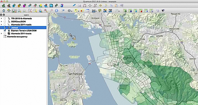
A view of Alameda census info over Stamen’s terrain map in QGIS.
If you’re a novice mapper, tools like Google Fusion Tables (aka the WordPress of mapping) might make Quantum GIS look like rough terrain.
QGIS is an open source powerhouse for mapping that has a number of advantages. It’s free (as in free speech) runs on Mac or PC and you can import shapefiles, coverage data plus any personal geodatabases you may have on hand.
So get over yourself and try it, advised Len De Groot of Knight Digital Media Center in his recent online Intro to Data Mapping class.
“It’s not for the faint of heart. But there’s a lot of drag and drop, something most of us can do,” he said in the hour-long session to a group of around 60 global journalists. “You do have to build up some muscle memory on how this works, but it will make your data mapping much more robust.” Continue reading